I lived in Denver for two years before discovering Cherry Creek Trail properly. Not just the downtown part everyone knows.
The whole thing. 22 miles from Confluence Park to Cherry Creek Reservoir.
Now I bike it weekly. It completely changed how I see the city. Here’s why you need to ride this trail.
The Trail Nobody Talks About
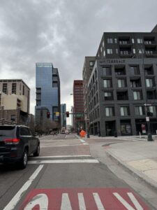
Everyone knows about the downtown section. Confluence to Cherry Creek Mall. That’s like 3 miles.
But the trail keeps going. Through neighborhoods tourists never see. Past country clubs. Under highways. Into actual nature.
It’s Denver’s secret highway for bikes. No cars, few pedestrians, just smooth concrete for miles.
My Favorite Route (And Why)
Start: Confluence Park
End: Cherry Creek Reservoir
Distance: 11 miles one way
Time: 45 minutes there, forever to explore
Mile 0-2: Downtown to Speer
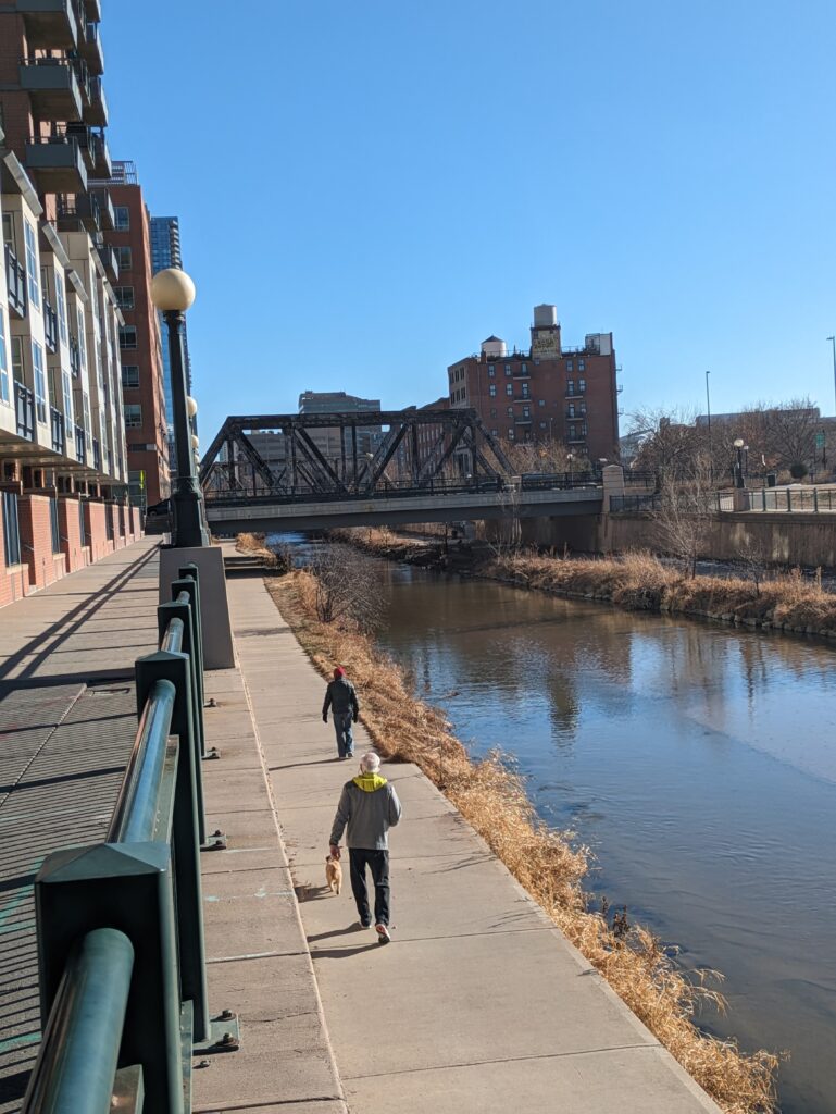
Start at Confluence. Follow Cherry Creek southeast. This part’s busy but sets the mood.
Pass under bridges. REI on your right. Denver skyline behind you.
Mile 2-4: The Fancy Neighborhood Stretch
Country Club area. Massive houses. Private tennis courts. Different Denver.
The trail is tree-covered here. Feels like a secret passage through rich people’s backyards.
Mile 4-6: Cherry Creek Shopping Area
Pop up at the mall if you need anything. Otherwise stay on trail.
This section has actual creek views. Ducks everywhere. Sometimes deer.
Mile 6-8: The Forgotten Middle
This is where casual riders turn back. Their loss.
Trail gets quieter. More nature, fewer people. You forget you’re in Denver.
Mile 8-11: The Reward
Dam comes into view. Trail opens up. Cherry Creek Reservoir appears.
Beach area, marina, massive views. This doesn’t feel like landlocked Colorado.
What Makes This Trail Special
It’s Below Street Level
Most of the trail runs below the city. You’re in a green corridor while Denver happens above.
Traffic noise disappears. Just birds, water, bike tires on concrete.
No Road Crossings (Mostly)
Underpasses everywhere. You rarely stop. It’s continuous flow for miles.
Compare that to street biking where you stop every block.
It Shows Denver’s Layers
Homeless camps under bridges. Million-dollar homes above. Office workers on lunch walks. Kids feeding ducks.
You see how Denver actually fits together.
The Bike Rental Strategy
BCycle stations: Along the trail but only downtown section
Better option: Rent from Campus Cycles or SloHi Bike Co
E-bikes: Game changer for the reservoir ride
Don’t use those scooters. Trail rangers will yell at you.
When to Ride
Best: Weekday mornings. Empty trail, cool weather.
Good: Sunday before 10am. Beat the family crowds.
Okay: Weekday evening. Busy but manageable.
Avoid: Saturday afternoon. Zoo.
Seasonal Reality
Spring: High water, muddy spots, gorgeous green
Summer: Hot but shaded, crowded, creek is perfect
Fall: Leaves are insane, perfect weather, best season
Winter: Often rideable, icy patches, completely empty
Trail Stops Worth Making
Mile 2: Creekside Park
Hidden park. Benches. Good bathroom. Water fountain.
Mile 4: Whole Foods
Right off trail. Grab snacks. Use real bathroom.
Mile 5.5: Pulaski Park
Pond with turtles. Picnic tables. Kids love it.
Mile 8: Garland Park
Baseball fields. Playground. Last bathroom before reservoir.
Mile 11: Cherry Creek Beach
Yes, Denver has a beach. Swim, rent kayaks, or just stare at water.
The Local Sections
Confluence to Speer: Tourist Denver
Speer to Colorado Blvd: Rich Denver
Colorado to Monaco: Regular Denver
Monaco to Reservoir: Suburban Denver
Reservoir: Wait, this is Denver?
My Actual Weekly Route
Tuesday mornings. Leave home at 7am.
Bike to Confluence (warm up). Trail to reservoir (workout).
Coffee at reservoir marina. Sit by water. Pretend I live somewhere coastal.
Ride back different pace. Stop at parks. Take photos.
Home by 10am. Whole day still ahead.
Why This Trail Matters
Denver feels disconnected sometimes. Neighborhoods separated by highways. Downtown isolated from suburbs.
But this trail connects everything. You can bike from downtown lofts to suburban reservoir without seeing a car.
It’s the Denver nobody shows tourists. The in-between spaces. The quiet parts.
Tips Nobody Mentions
Goose poop season: June-July, path gets gross
Homeless camps: Under some bridges, never had issues
Flash floods: After rain, trail can flood, check conditions
Wind: Afternoon headwind going east is brutal
E-bikes: Technically speed limit but nobody cares if you’re reasonable
The Combo Routes
Cherry Creek + High Line Canal: 30+ mile loop option
Cherry Creek + Platte River: Make a full city loop
Cherry Creek + City Streets: One way trail, different way back
What Changed for Me
I used to think Denver was just downtown and mountains.
The trail showed me the in-between. The neighborhoods. The hidden parks. The actual creek that named everything.
Now when people visit, I make them bike this. Not the touristy stuff.
Because this is how Denver actually lives. On trails, by water, between the city and nature.
That’s the real Denver. And it’s been here all along.
Do you bike Cherry Creek Trail? What’s your favorite section?
Related: Why Confluence Park Is Denver’s Best-Kept Secret for Families – where the trail begins.

Need a Ride?
Book Sam's premium car for hire service for reliable transportation in Denver.
Book Your RideOr call: (720) 900-5430